Ready to go camping? You need a destination. Here’s everything you need to know to find an epic spot.
Where Should You Look?
Here in the United States, all of us are incredibly fortunate to own 985 million acres of public land. And yes, you can actually just go camp on a lot of that, simply by following some basic guidelines.
Within that system, there are some types of land that are better than others. Most National Parks, for instance, require that you camp in designated campgrounds, or backcountry sites which will be inaccessible by vehicle. Both need to be booked well ahead of time. In contrast, on National Forest and Bureau of Land Management lands, you can simply drive down a dirt road or trail, and camp pretty much anywhere you please. Depending on factors like the management agency responsible, the presence of rare or protected species, and season, that may also be true on National Seashores, some National Monuments, and on state-owned lands.
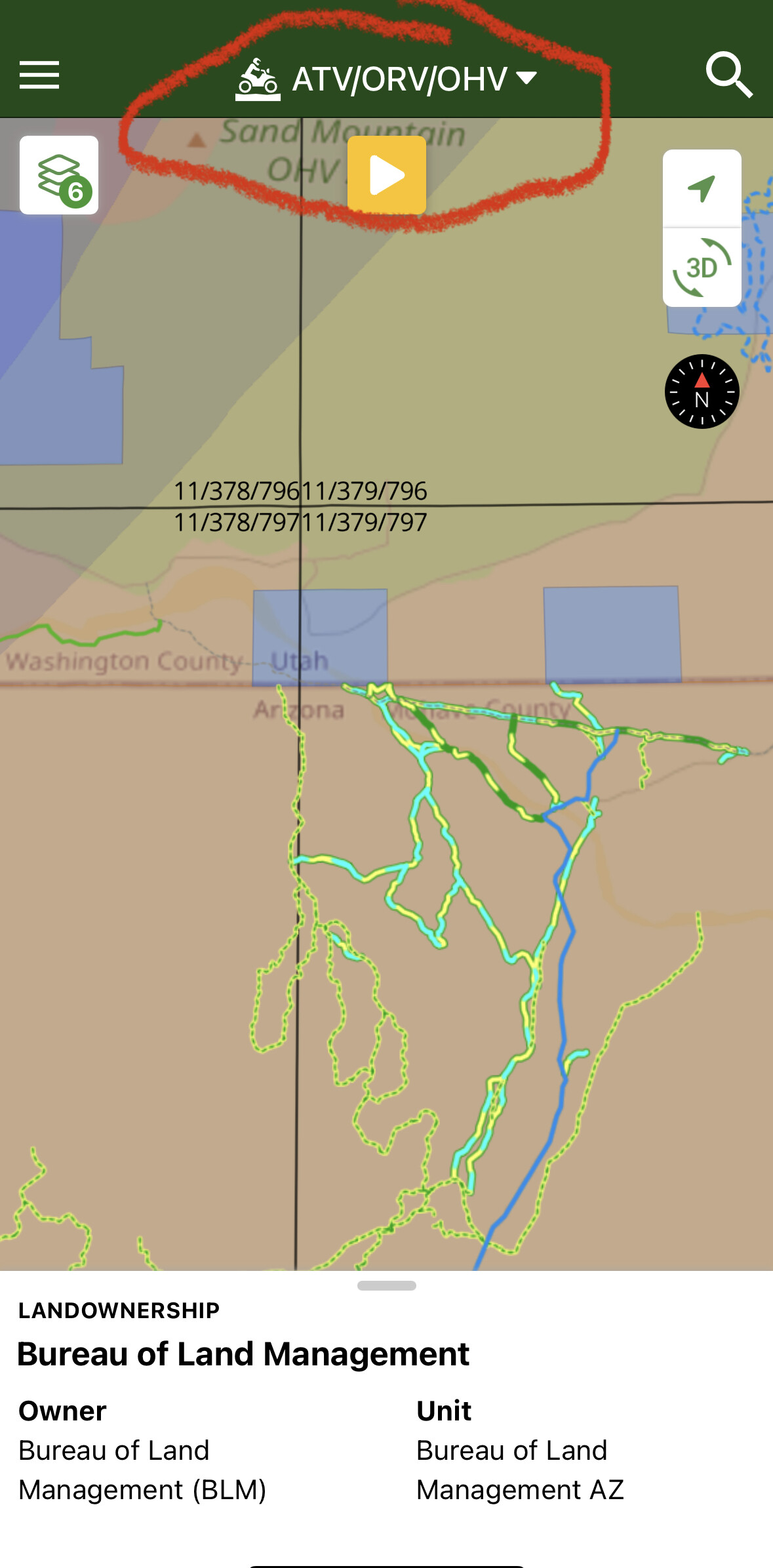
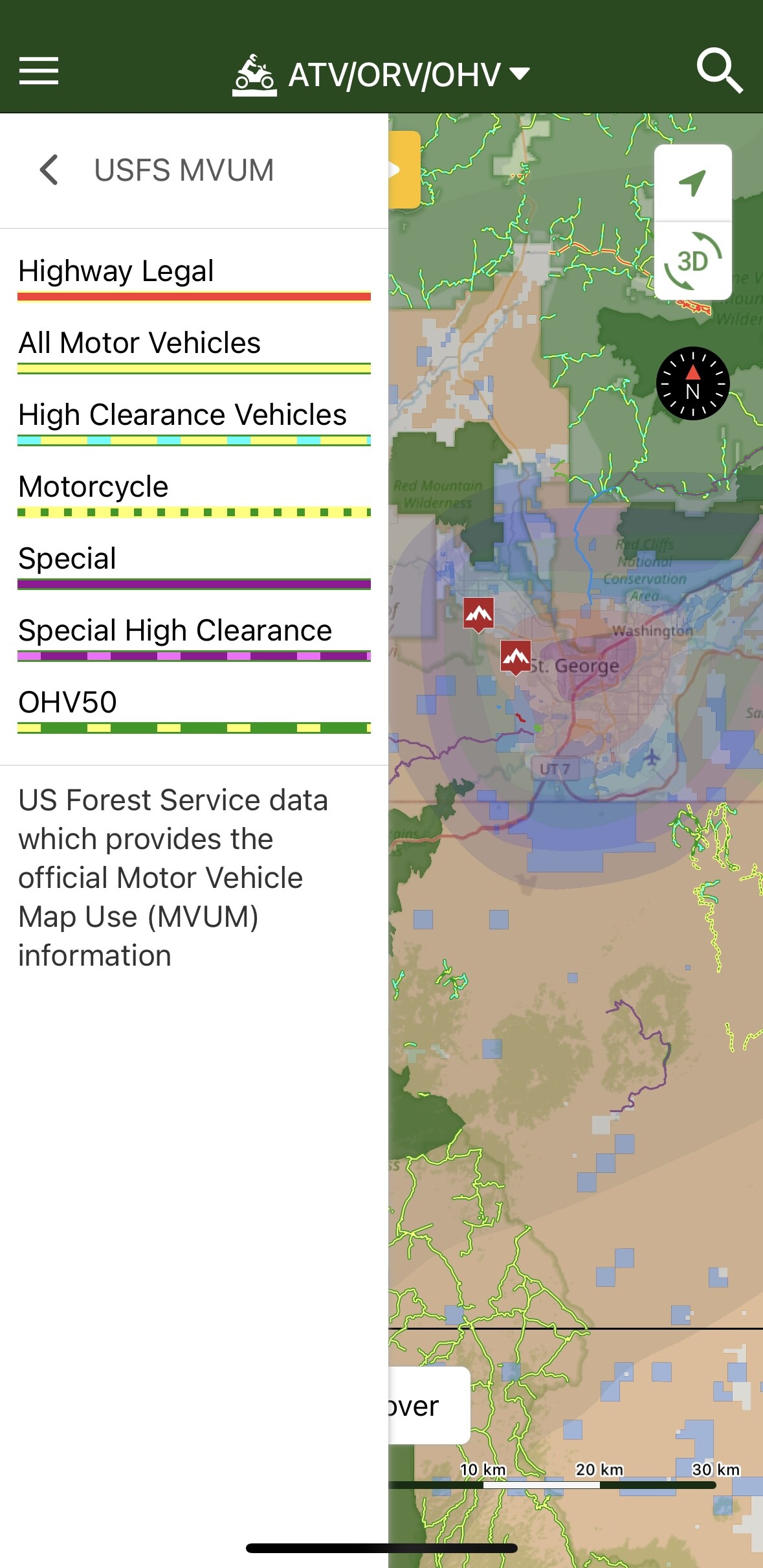
The best way we’ve found both to figure out which type of land you may be on, or to find specific types of areas, along with dirt roads and trails that allow you to access them, is with a smartphone app called OnX Offroad ($30/year, iOS, Android). OnX works in a similar fashion to Google Maps, displaying your location with a blue dot, but visually distinguishes the boundaries between different types of land, and highlights dirt roads and trails through them. Helpfully, it ranks many of those trails by difficulty, shows you what types of vehicles will be able to use them, and shows you which trails are open or closed by season.
To find a route or destination on OnX Offroad, simply pull up an area you might be interested in, look for appropriate types of public land—typically National Forest, BLM land—then identify routes appropriate for your experience level and vehicle(s). There’s not necessarily a need to identify a specific campsite ahead of time as on-the-ground factors like the presence of other people and weather may dictate you remain flexible.
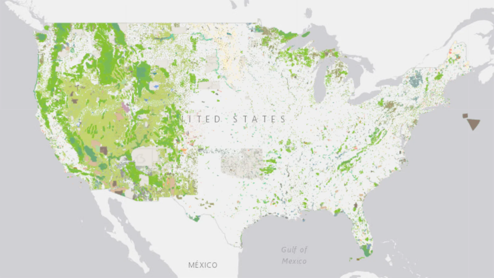
A map of all publicly-accessible lands in the lower 48. You can explore this map yourself here.
Where Can You Camp?
Let’s talk about the difference between campgrounds and campsites first. Campgrounds are formal camping facilities that typically provide a parking spot, a cleared area to set up a shelter, a metal fire ring, a picnic table, and often some sort of bathroom and maybe even showers. Most campgrounds require a fee, and many may need to be booked ahead of time. Recreation.gov provides a comprehensive directory and booking service for public lands campgrounds, while corporate operators like KOA or HipCamp also provide campgrounds on private land.
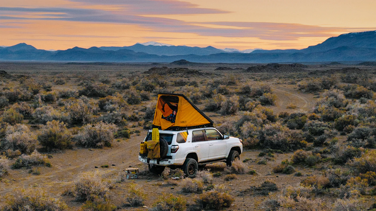
In contrast, a campsite is simply a spot where you decide to camp. Ideally there won’t be other people around, and there won’t be any facilities—it’ll just be you and nature.
GFC prefers, and strongly recommends simply finding your own campsite on public land.
By doing this, you’ll be participating in an activity called “dispersed camping.” On National Forest and BLM land, there’s just a few basic rules about where you can camp:
- Camp at least one mile away from designated campground, trailhead, or recreation area.
- Camp at least 100 feet away from any water source (lakes, rivers, streams etc).
- Camp within 150 feet of a road or trail.
- Don’t drive off a road or trail. Your tires need to remain on ground other people have already driven on.
- Camp on bare ground rather than on top of grass or other plants.
- The least impactful sites are places where someone has camped before.
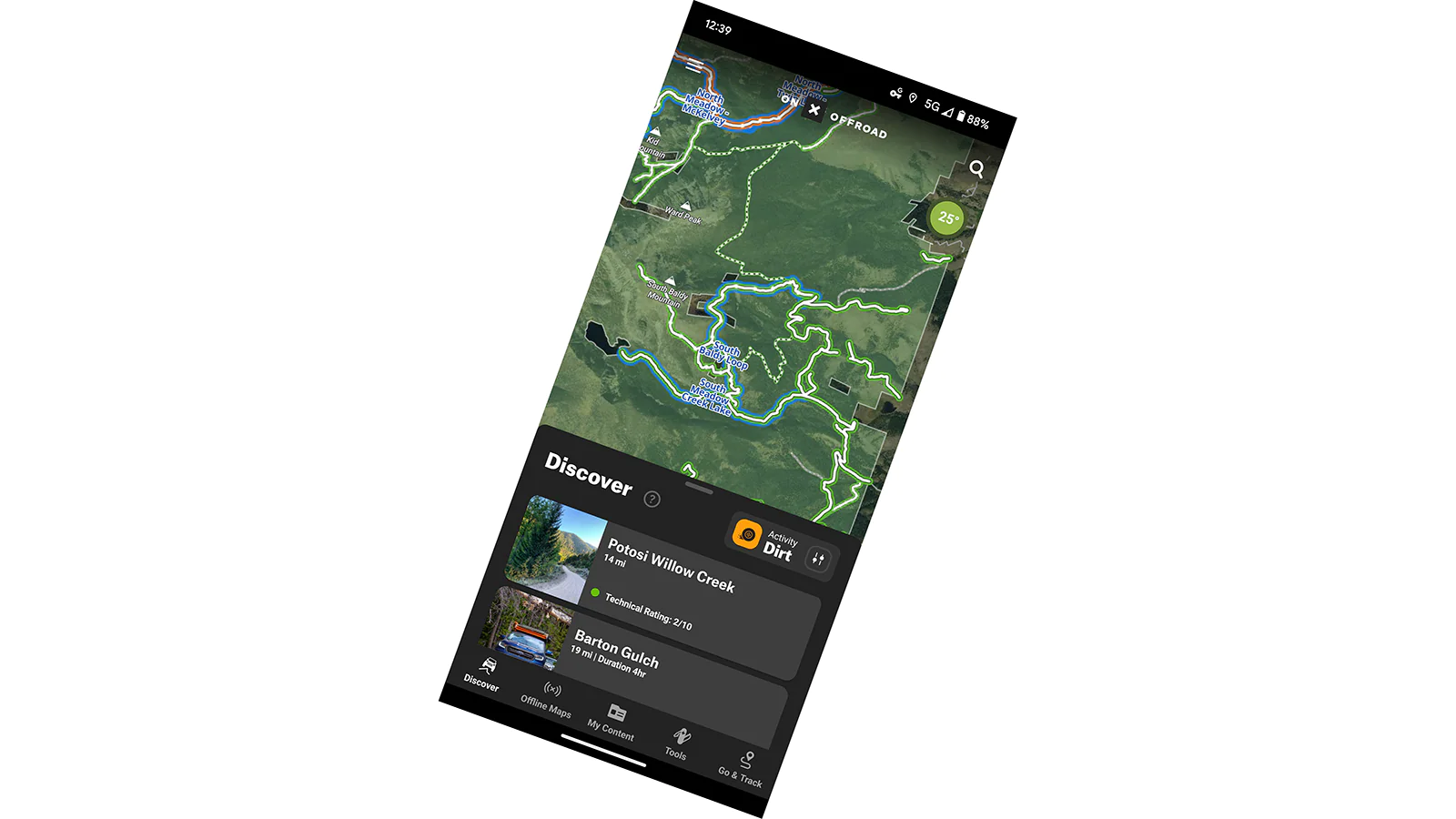
OnX Offroad provides, simple, intuitive information on accessible trails, land boundaries, difficulties, and even suggested routes.
Are There Rules?
It’s a good idea to Google the area (say: “Custer-Gallatin National Forest + Camping”) you intend to travel through ahead of time, and to observe any posted restrictions or closures. But in general, the following guidelines will keep you on the straight and narrow.
Fire
- Observe any local restrictions.
- Where possible, use an existing fire ring in a previously used campsite.
- If no fire ring is present, build your own from rocks on bare earth, well away from any vegetation. Be careful to avoid overhanging branches.
- You’re free to gather dead wood for a campfire, but don’t harm any live plants or trees.
- If bringing your own wood, try to pick it up at a local source close to where you plan to camp, to avoid spreading invasive bark beetles.
- Before going to bed, leaving the campsite, or otherwise leaving the fire unattended, ensure it is fully out by saturating it with water, then stirring that water through the ashes and coals until everything is cool to the touch.
Human Waste
- Find a good poop spot that’s at least 100 feet from any water source, and well away from camp.
- Dig a hole that’s about six inches deep. The bacteria that breaks down human waste lives in the top layer of soil.
- Leave behind only human waste. Prepare ahead of time to safely pack out your toilet paper, baby wipes, and sanitary products.
- Or, pack outeverything , and dispose of it in a municipal dumpster back in civilization. This may be your only option when visiting areas like deserts and beaches.
Trash
- Pack everything out.
- If you see trash left by other users, pack that out too.
- Leaving places better than you found them ensures all of us will continue to be able to enjoy the outdoors.
You can find additional guidance from Leave No Trace.
Need some recommendations on good destinations in your area? Ask the shop that installed your GFC, they’ll be able to point you in a fun direction.