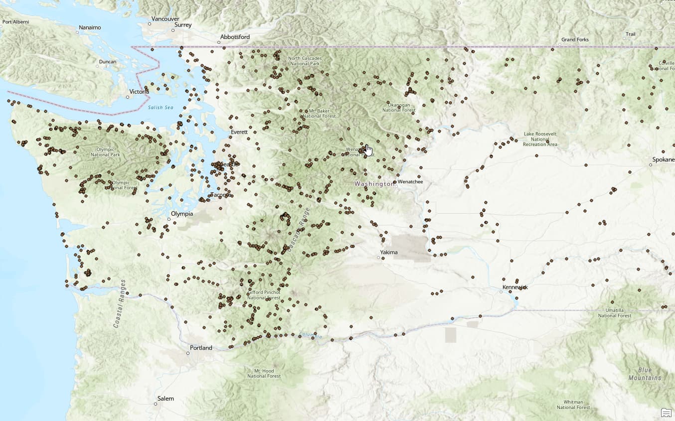
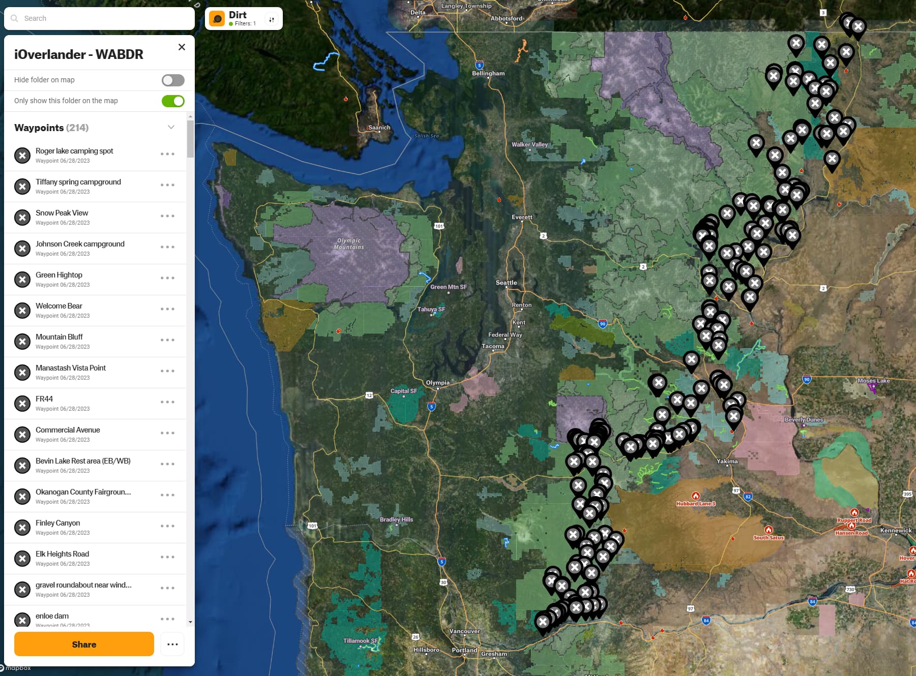
I work with GIS/maps for my everyday job, so I nerd out a bit with data. I learned last night that you could download iOverlander points as a KML/KMZ and had an idea to hopefully make my WABDR run a little easier.
I am a person who enjoys having a plan, but am running the WABDR with no planned campsites. Figured it would be nice to have locations from iOverlander available offline in OnX so as I’m getting ready to wind down for the day, I have some backups if I can’t find a site organically
Step 1: download iOverlander points and bring into ArcGIS Pro. Not shown: clipped the points to Washington, exported that as a file so I have every iOverlander site in WA
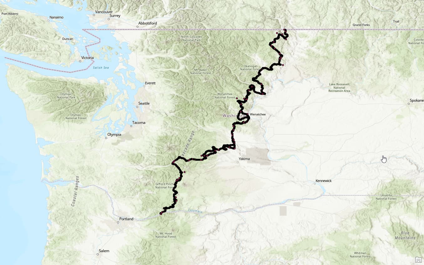
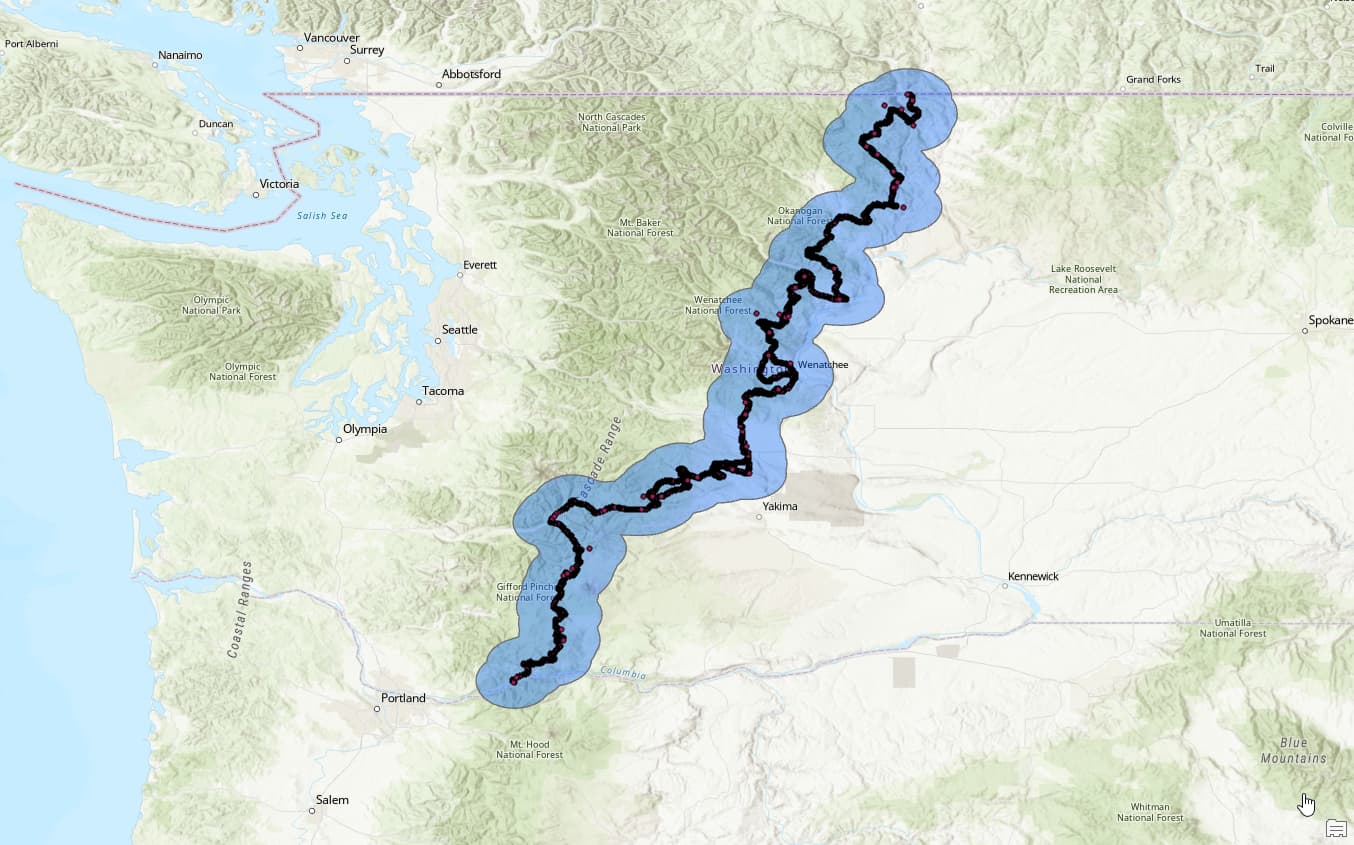
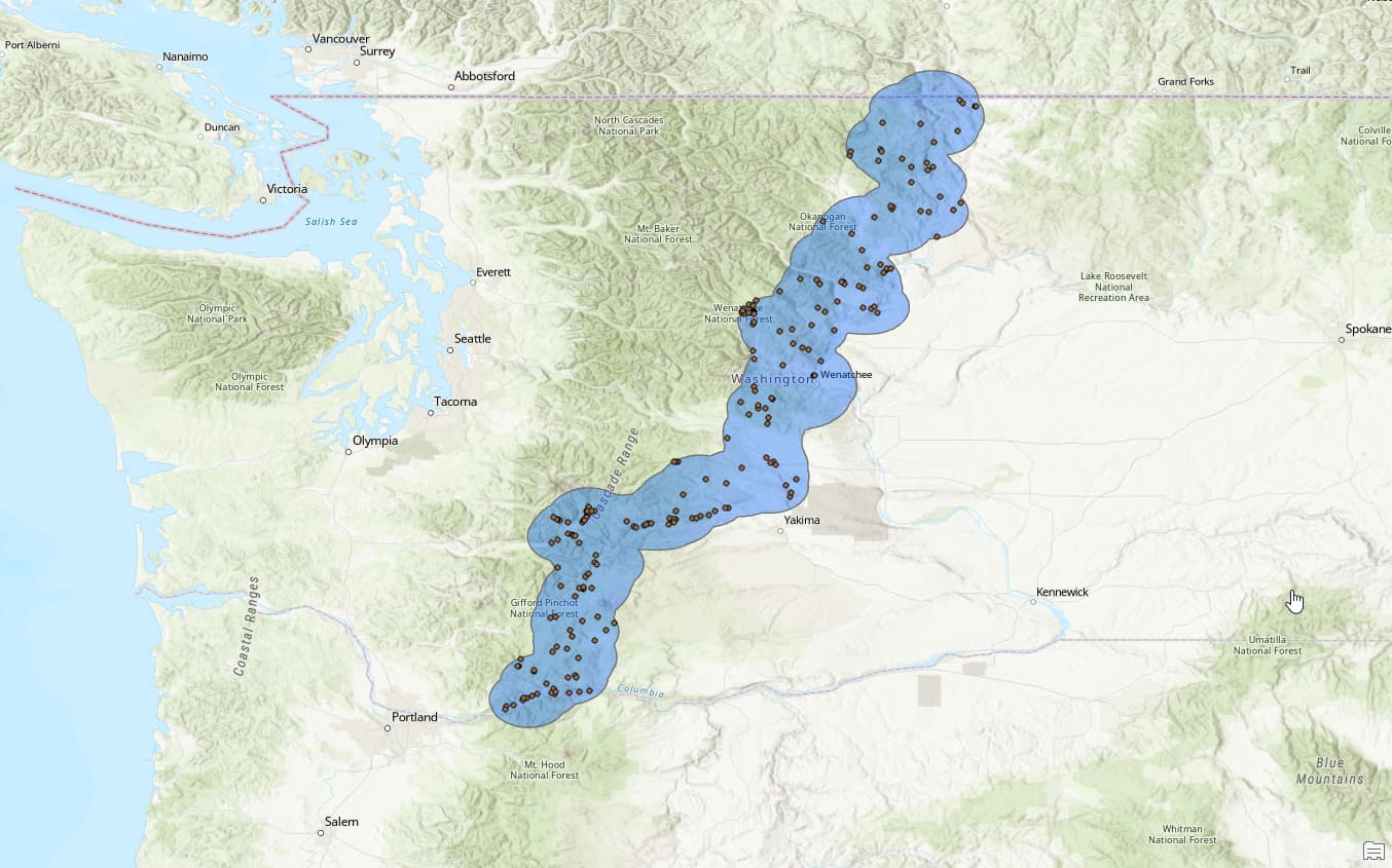
Step 3: add a 10mi buffer to the WABDR points. No rhyme or reason for 10mi, figured thats about all I’d like to trek off the trail when trying to find somewhere to crash
Theres probably better ways to do this and maybe this data is available from OnX, but I was getting rusty using this software and wanted a pet project to play around with. Fun stuff!
This is awesome! I’ve heard amazing things about the WABDR. I’ve done the full COBDR on a moto (CRF250L). They are amazing routes.
Camping a few weeks ago I ran into a retired couple riding 2up on a KTM and they’ve done almost all western BDRs. Said the Washington one was incredible!
Good to hear! Definitely a little nervous. Picked up a good Viair compressor, deflators, and tire plugs. Have a shovel but not much other recovery gear, anything you’d suggest before I head out?
Slow down and enjoy the moments! I have done sections at a time and also did the entire route in 5 days, which was to fast to enjoy the moments. Each BDR has its own magic, last July it was Wyoming that wowed me!
I am looking to take it slow and stop at some of the BDR waypoints. I have 9 days crossed off for this, but also want to make it over to Eastern WA to see my mom and grandparents for a day, so thinking about taking 6 to do the BDR and 3 over there!
What limitations exactly? I am downloading offline maps so I have rough aerials behind my content and I believe I read that any of “your content” is available offline anytime.
I am not thrilled with OnX as a product and will be going to Gaia after this trip. Part of that is being in GIS as a career, OnX is just a little too simple for me
When I go to download an offline map the choices are 5, 10 and 150 miles wide. The resolution on the aerials on anything but the 5 mile is terrible. For such a long route are you just downloading 150 mile increments and suffering the low resolution or is there another fix I’m missing?
I’m not really satisfied with OnX either. It’s great for finding trails but how they have quarantined data from certain packages really frustrates me (ex: OnX Offroad doesn’t show streams/rivers unless you pay for OnX Backcountry or OnX Hunt). Also the offline capability for an “overlanding” app is a joke. I end up using Landglide for parcel ownership, Pocket Earth for water features, and OnX for trail mapping.
Ah yeah, we’re on the same page. Yep, I just deal with shitty aerial resolution. Not ideal obviously, and a large reason I wanted to get these iOverlander points in. Hard to scan aerials for decent sites offline, so this at least gives me places to check out.
I haven’t had any experience in Gaia but I hear its “more complicated” which is exactly what I’m looking for. Like in OnX, I can’t figure out a way to create a route from point to point when you don’t want to start from your current location? That seems like such a simple map workflow but it is not obvious in OnX. Might be user error.
No experience here with OnX but a long time Gaia user here. It meets my needs with a few minor complaints. Creating routes is dead simple either from iOS or the web browser version. It meets my needs well enough that I haven’t felt the need to try something else.