Hey folks! Just wanted to drop in here with a write-up that I recently did on our website about some of our tricks for finding camps while we have been traveling. Hopefully, some of you guys find this information useful, holler if you have any questions!
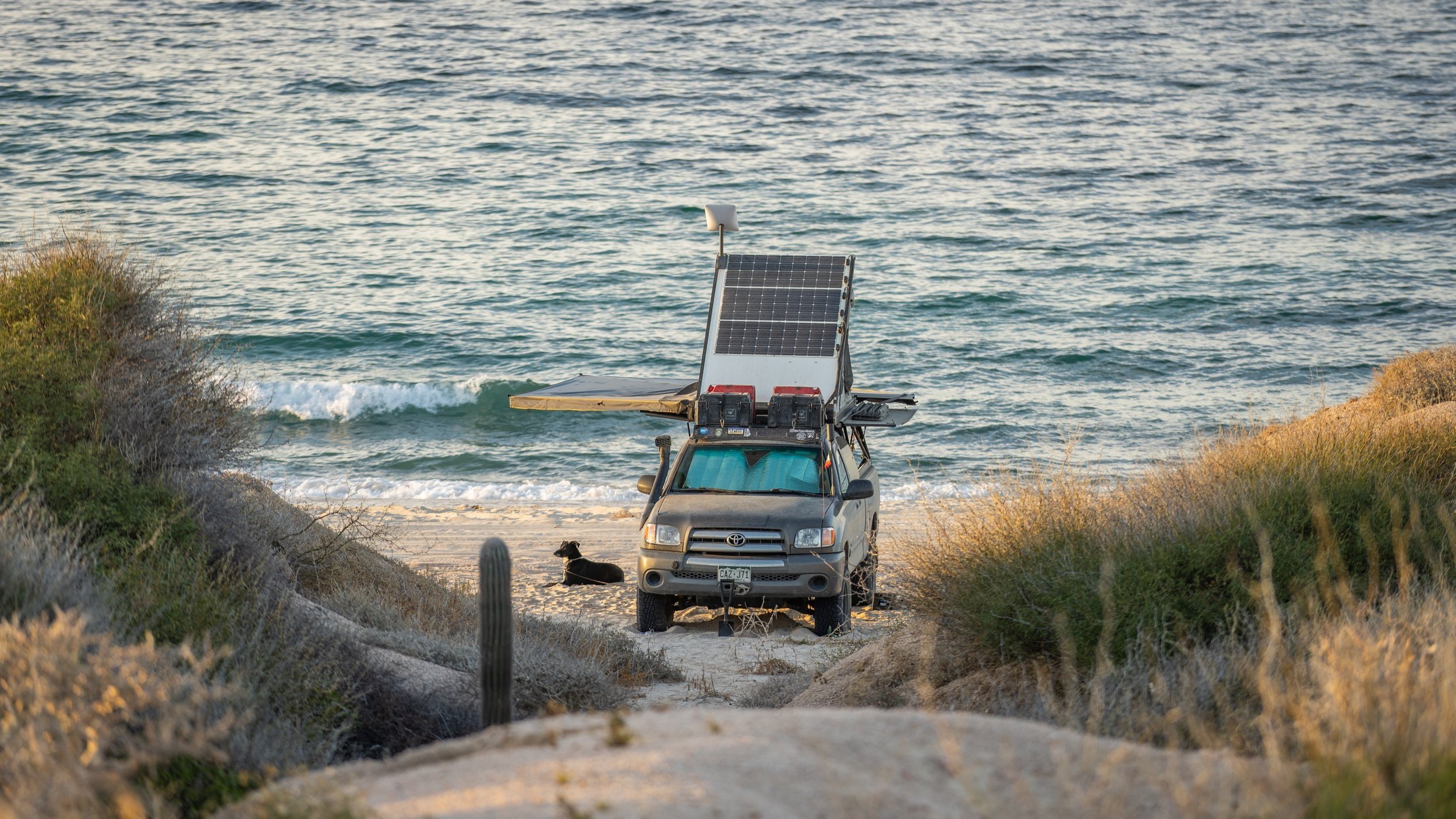
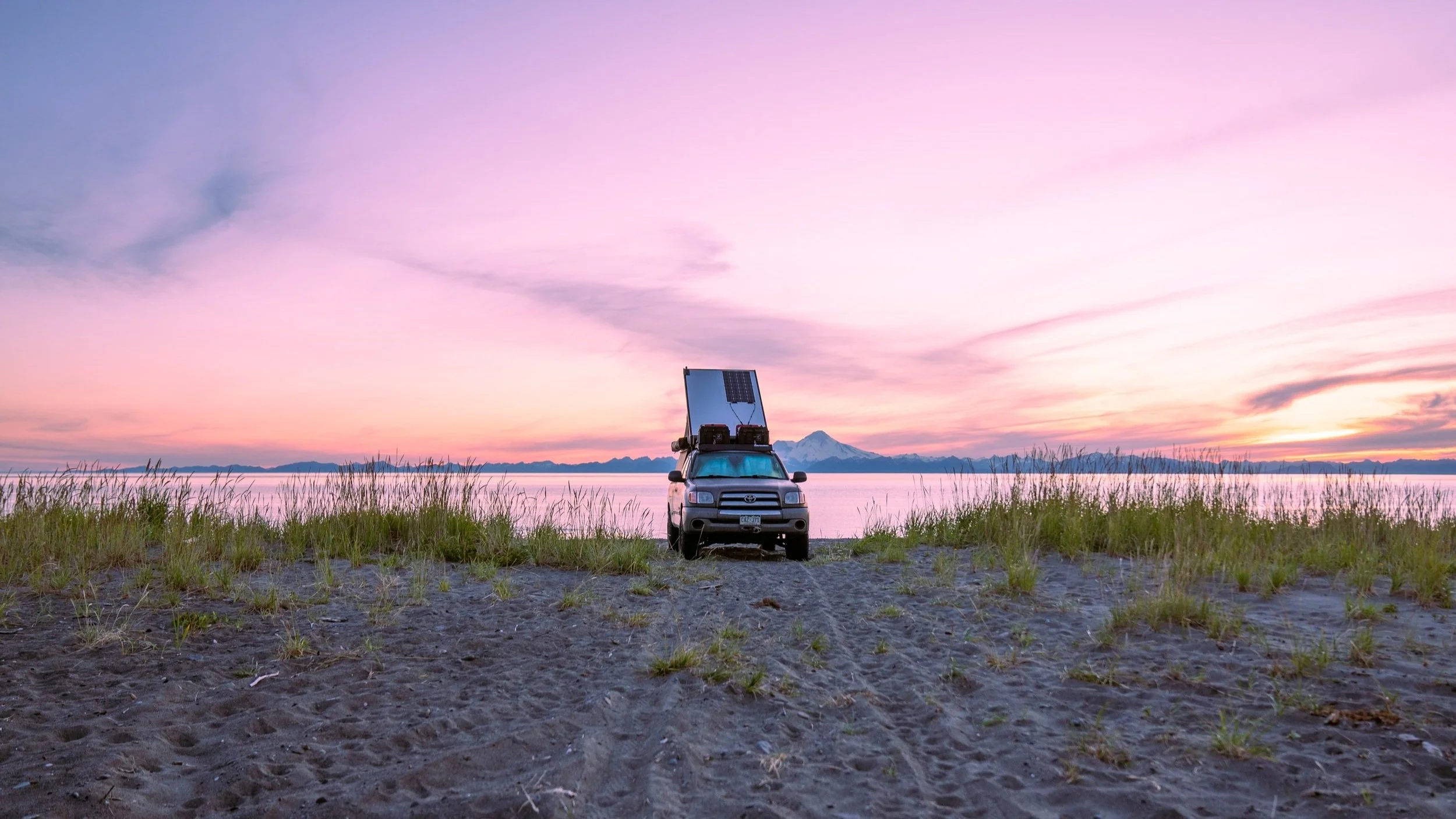
Finding incredible camps has been one of our favorite aspects of living life on the road, so much so that when we’re not traveling, it’s one of our favorite couch activities. There are few things we like more than waking up in our private slice of this incredible globe we live on. Whether on mountain ridges blanketed in wildflowers, deep in desert canyons nestled between sandstone walls, or on secluded beaches in Baja surrounded by Cardón cacti, seeking the peace and beauty that these places can offer has always been a driving force for us.
Over the years, we have slowly refined the ways in which we find these campsites, certainly not without some trial and error. Lately, we feel that our system has been honed to a point where we are now confident in sharing some of our expertise, learned through our trials and errors on the trails.
Before we dive deep into this topic, please take a few moments to read through the seven principles of Leave No Trace, as well as how to go to the bathroom in the woods if you haven’t already. We believe that beautiful places are made even better when it feels like you’re the first person to visit, and few things detract from that experience more than a large pile of trash or brown wet wipes. It’s important to preserve the natural beauty of these places for others and ensure that they stay beautiful and open for years to come.
Our Preferred Kind Of Camp
Let’s start with our preferred type of camping spot! The ones that really speak to our hearts and eyes are often found in remote areas, offering distant views free of reminders of civilization. Ideally, the road we traveled to access these spots is the only reminder of the outside world. We prefer to find these spots on public land, where we are free to roam and explore, walk along a ridgeline, or follow a wash to its end. We rarely seek out established campgrounds, except when we are traveling long-term and need amenities like laundry or a shower. Therefore, we won’t be discussing those types of campsites much in this article.
What tools do we use to find them? Google, Gaia, iOverlander, & an Atlas
Finding these spots and planning our next adventure has always been a favorite pastime of ours. We often spend hours poring over maps, searching for hints of areas where people may have camped before. It’s important to note that great spots are found, not made, and when we’re traveling, we make sure not to unnecessarily drive over or trample vegetation. We always stay on designated routes and trails to preserve the natural beauty of these areas and ensure that they remain open and accessible for future outdoor users. So, let’s talk about the tools we use to plan our adventures.
Google Maps
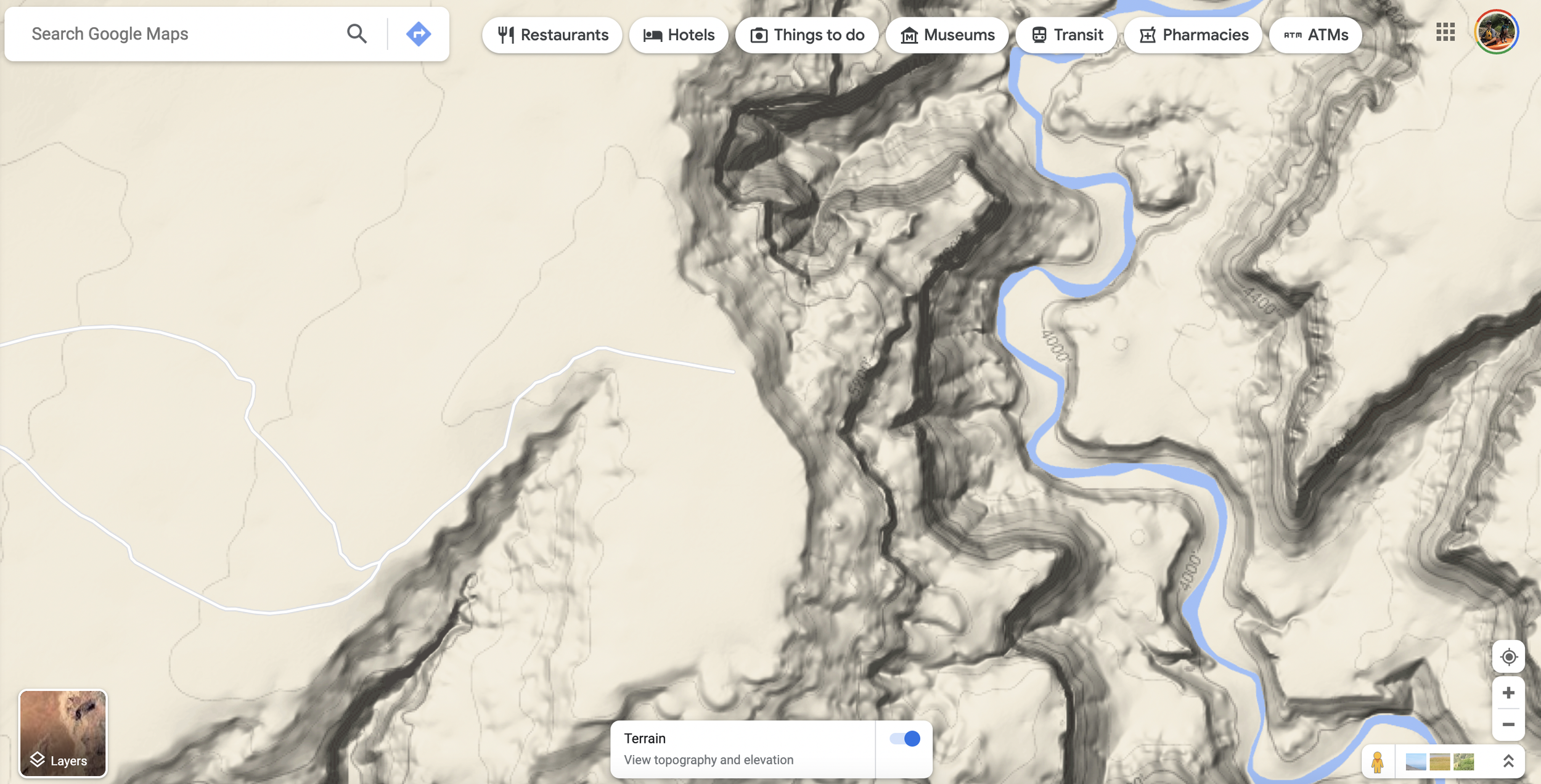
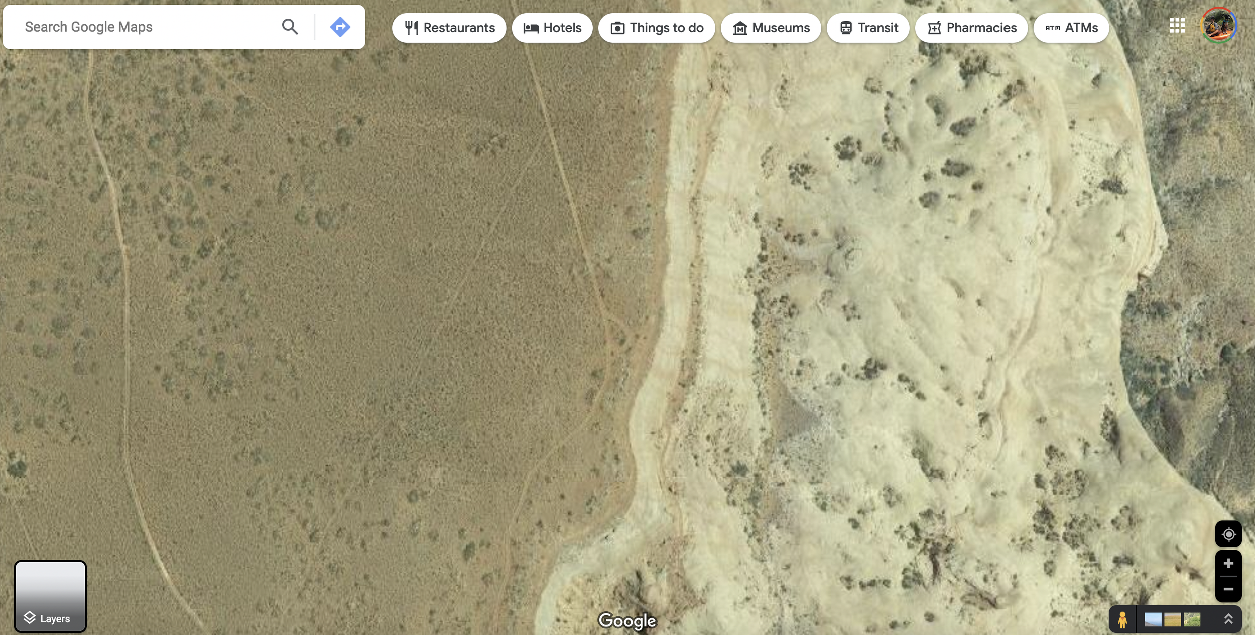
Google, is an incredible tool, and honestly, probably the one that we use the most! It’s packed with helpful features that really can quickly dial us into a dreamy spot and most importantly it’s free! Let’s say for example we are hoping to head to the Utah desert for a few days and really want to hang out along some sandstone canyon cliffs. Generally, the first place we would start is with Google in terrain mode. This feature does a great job of showing the topography of the landscape and also the roads. While using this layer we can find roads that may line or lead to a canyon edge, like so.
Once we find a road that seems promising we will then switch over to satellite view. While looking at the sat view we are generally looking for traces of vehicles turning around. These often look like teardrop tracks and generally provide a good hint saying that a particular spot is large enough to camp in, or that it’s level ‘enough’. These tracks also illustrate the importance of staying on the trail and not creating new camp spots because of how large an impact camping in a spot can have that it’s clearly visible in sat images. Usually once when we have focused our attention on an area like the one below, we will start scrolling around and visually following the road looking for these hints.
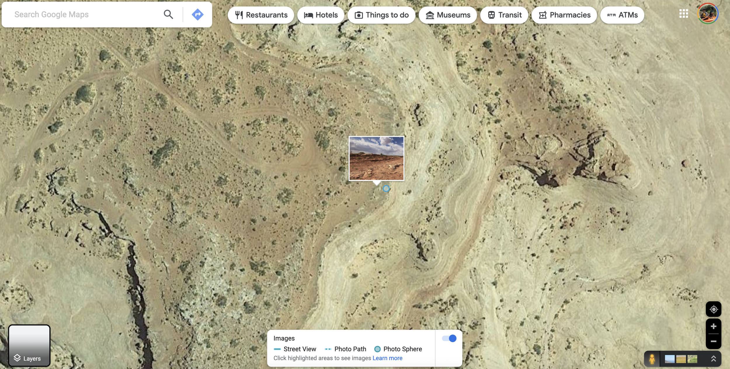
One of the other helpful features that is built into Google is user-uploaded geo-tagged photos. This is a really great way to clearly see the terrain of an area that someone has uploaded a photo from but it can also show some insight into how popular an area may be. If there are a bunch of tiny blue circles each representing an individual photo, maybe this is an area to avoid if you’re hoping not to see anyone. Secondly, these photos may provide great information about road or ground conditions either at the hopeful camp spot or along the road to it if someone has tagged those places.
iOverlander
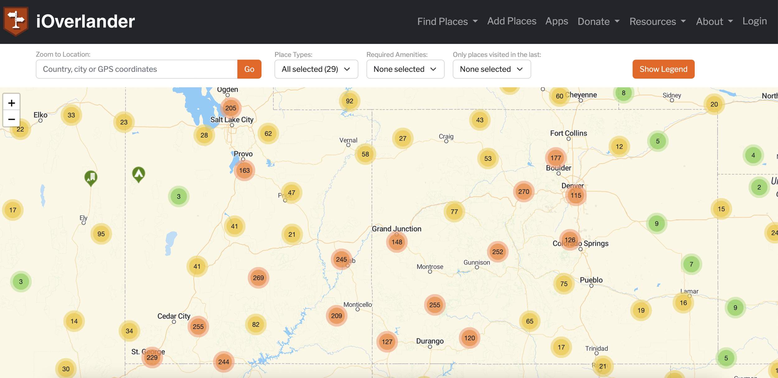
iOverlander is another incredibly helpful tool, and probably the one that’s easiest for most people to start using right away without a trial and error learning curve of scrolling through Google Maps for hours. Not only does iOverlander have filters for finding camp spots they also have all sorts of other user input data like laundry, grocery stores, road conditions, and so on. We find these features most helpful when we are living and traveling on the road for long periods of time or driving specific routes such as the Dempster Highway. On top of all of this, there are reviews and photos that users can submit, this is really helpful to know if the information is still correct, or if a specific spot or gas station has been closed.
For finding camp spots with this app we rarely go to the exact spot that is marked on the map. Rather we like to use these as good starting points to roll back to Google Maps to see if there are other options that we may find.
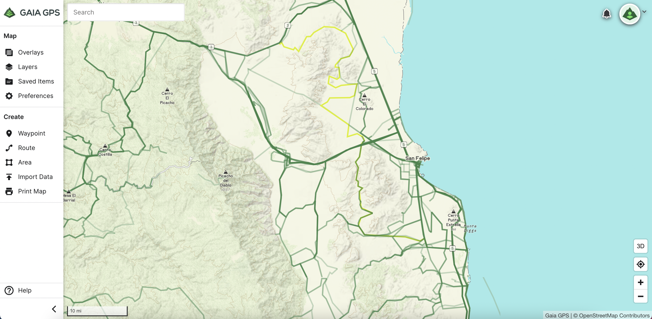
Gaia GPS
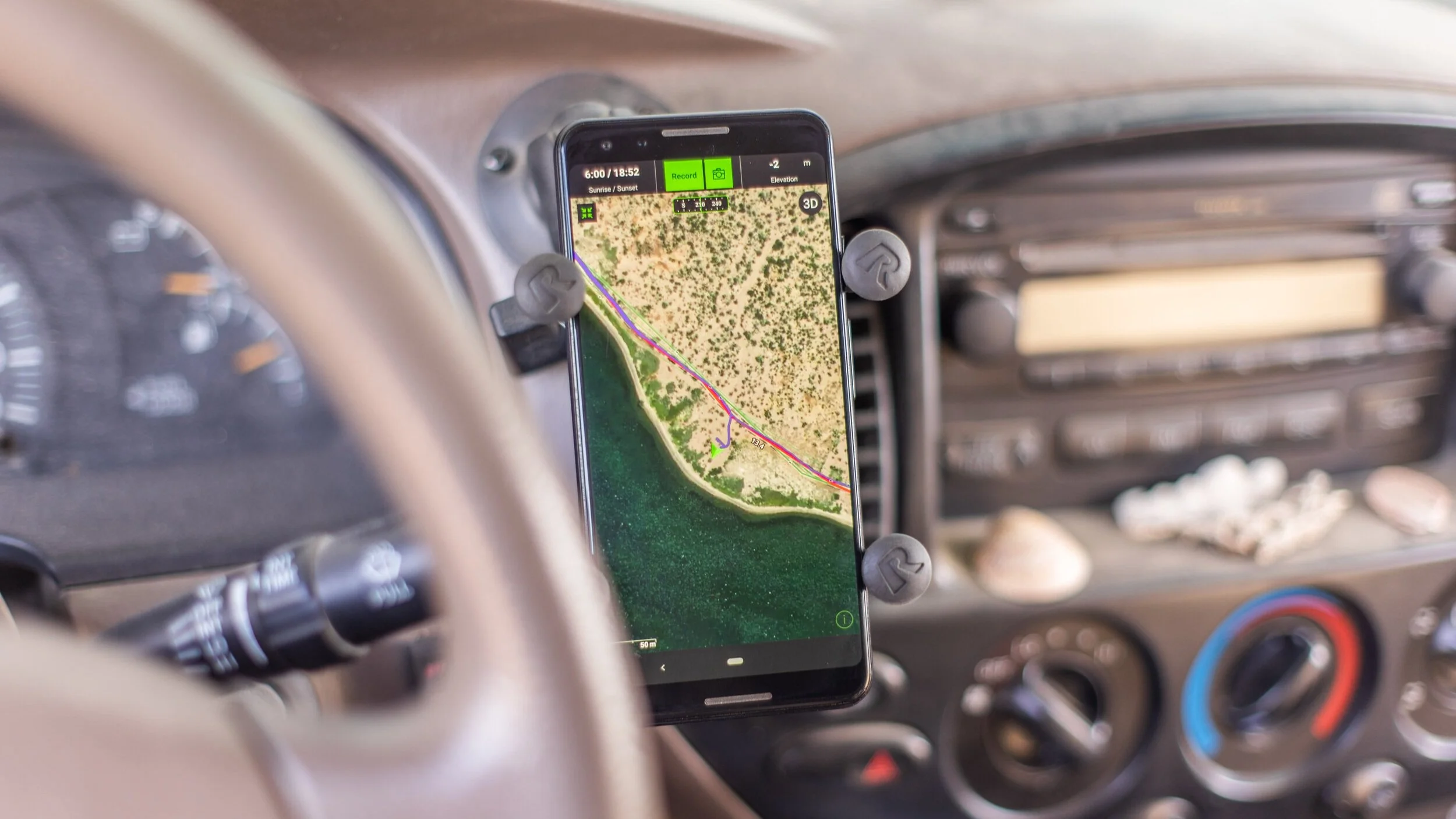
This app is one that we rely on the most while in the process of traveling for a whole lot of reasons! One feature that is now built into it is public and private land boundaries, this is of course extremely important to make sure you’re staying on public lands when out and about and wild camping. There are a ton of maps and filters that can be downloaded and used offline as well as several great ones that require signal like NOAA weather forecast to cover a large portion of North America.
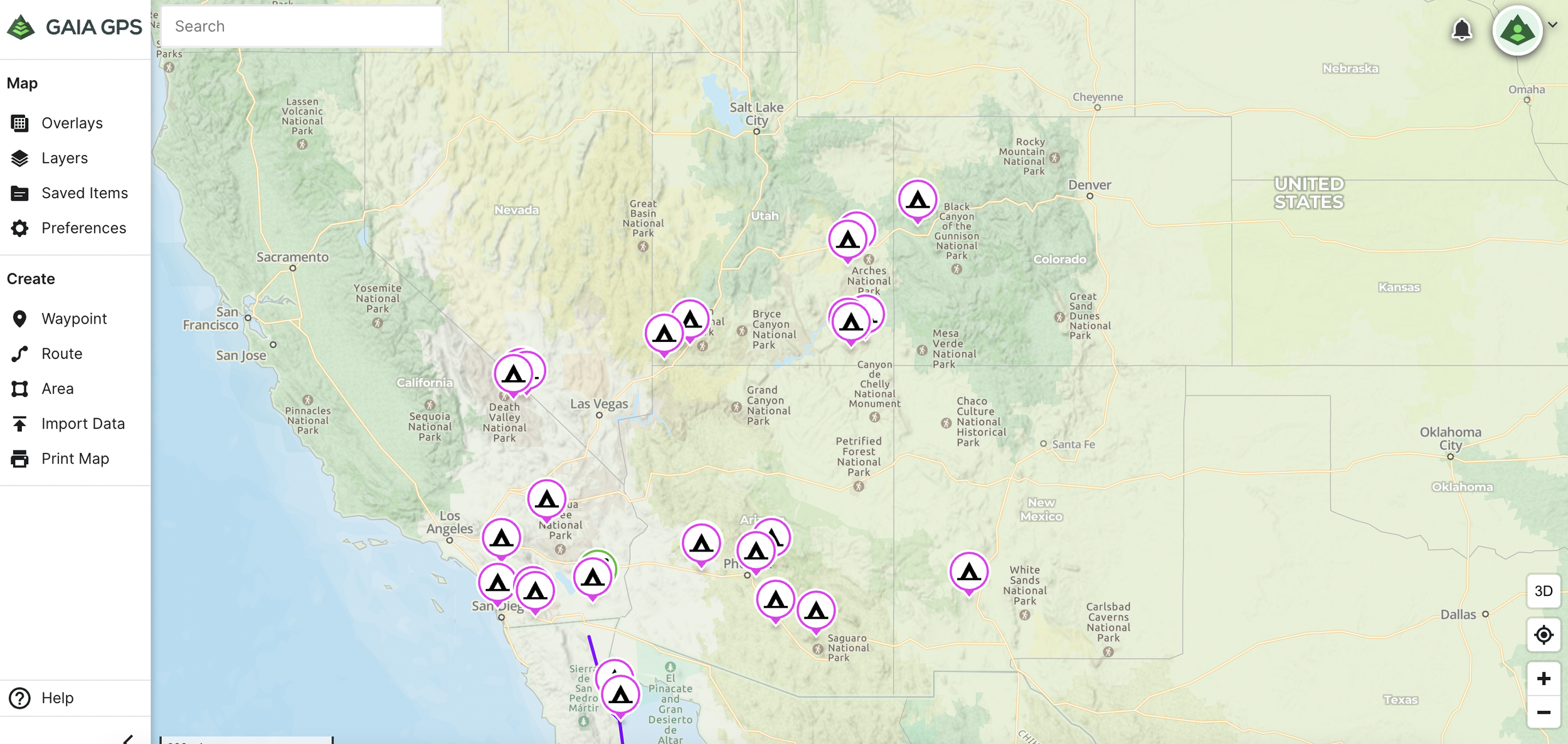
The primary thing that we use this map tool for is navigation, specifically while on trails. After we have gone through the process of finding out where we want to camp for a few days, or several spots that we want to visit we will add them to our Gaia map. Then after they are all added and marked we will make the route to those locations. Once all of that is completed we will download the map along the route for offline use while we are away from cell signal or in between uses of Starlink. Some incredibly helpful information on how to use Gaia can be found here.
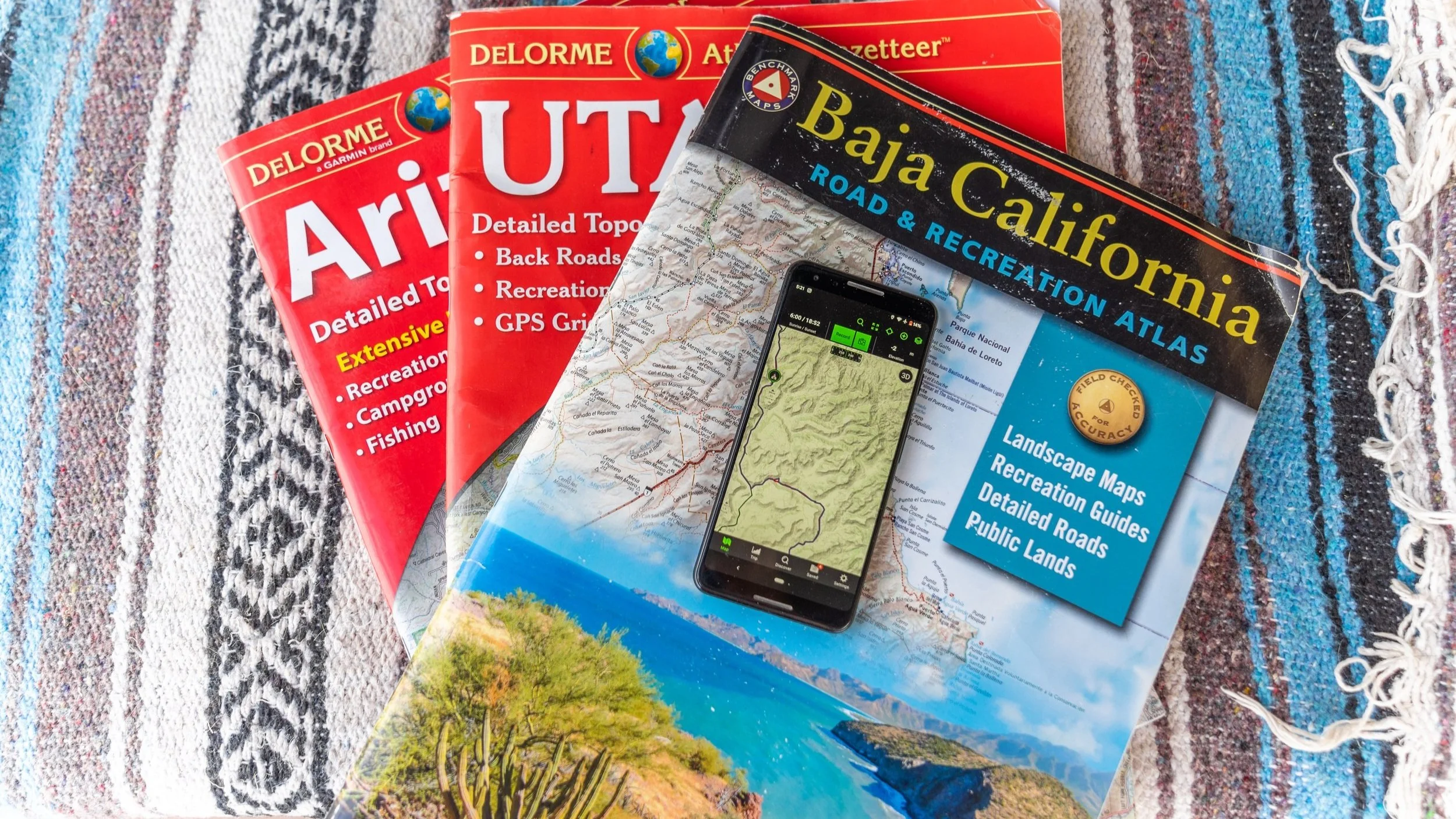
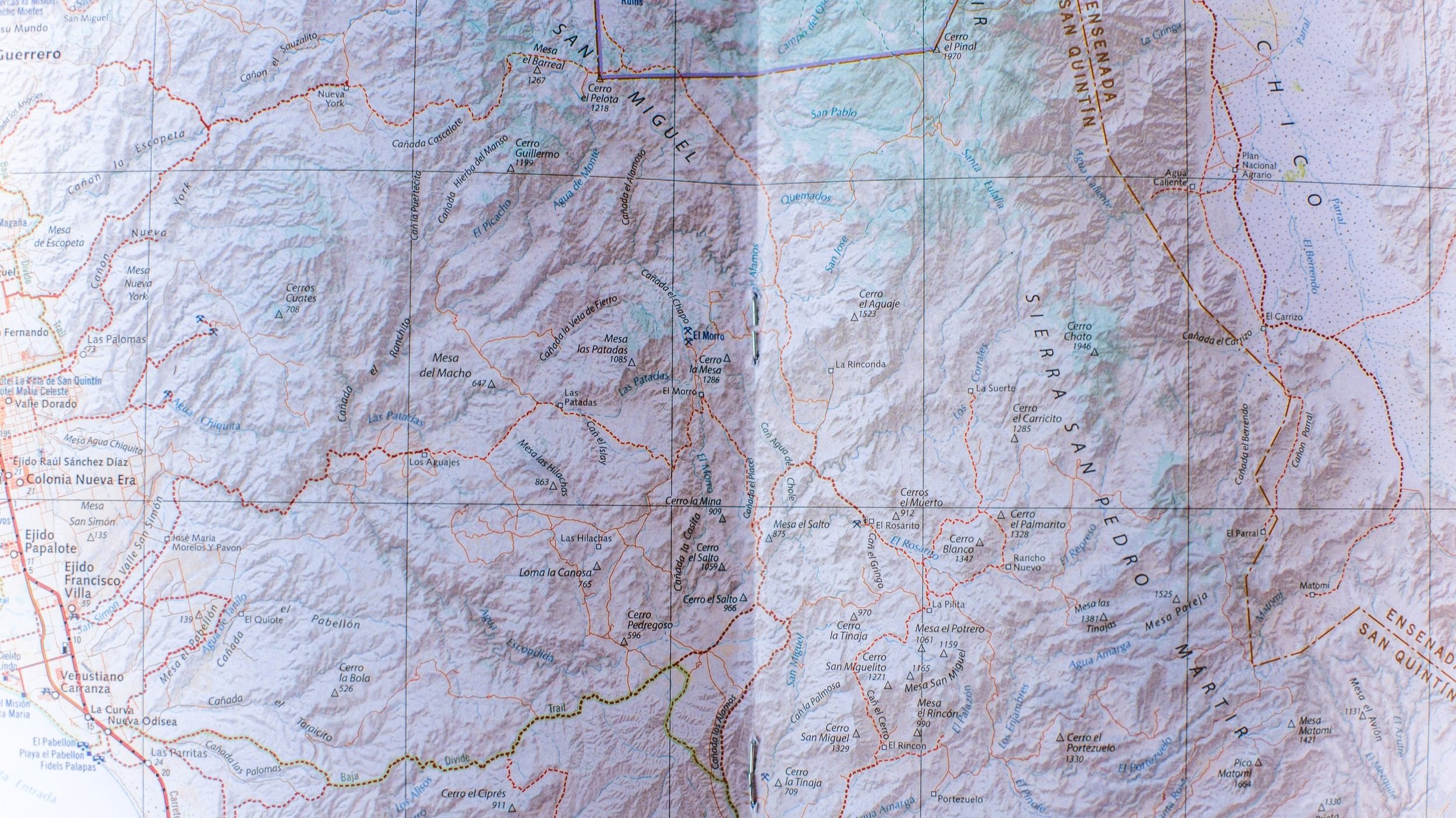
Delorme Atlas & Gazetteer
Nothing will ever replace the feeling of holding a paper map for us! At the risk of dating ourselves, we both remember getting around before the days of GPS when map on paper was significantly more common and printing out Mapquest directions was standard practice. Today, we don’t find ourselves navigating via paper maps very often but we still have a growing collection of these from each state we have visited! We use these a lot to glance over an area that we may be traveling to, occasionally they have some things listed that other mapping programs don’t, like fishing areas, and expected species within those areas. These maps also do a great job of representing the road surface to an area, which may be important information based on the vehicle you’re traveling in.
How we determine road conditions
This one is tricky and will depend greatly on a lot of factors! For us, we built our truck Dolores with the go-anywhere mindset, and generally, that same mindset applies to finding camp. However, that same mindset isn’t true for the person in a small sedan, or a very long-wheelbase RV where their vehicle may not have the same capabilities as a 4x4 truck. Even further some drivers may be more or less comfortable and confident driving through rough terrain. This area of learning how to wild camp is probably one that has the largest potential to get people into some trouble, getting a vehicle stuck or damaged a long way from assistance can be a deadly affair.
So, how do we determine road conditions?
We still haven’t dialed in a foolproof method for this, but we use several tools to help us get an idea of what we might be heading into. The one that we rely on most heavily is, again, Google satellite images. By this point, a large portion of the areas that we travel within Canada, the US, and Mexico are mapped in high-resolution images, so good you can clearly make out manhole covers or the difference between paved, gravel, or dirt surface roads. But what if it’s not in high-res sat images? That’s where things can get tricky.
If you have used iOverlander to find a spot that you may want to head to, oftentimes users will also submit information about the route that they used to get there and what kind of vehicle they believe is able to make it to or is suitable for that particular spot. All of that information is extremely helpful! Occasionally, users will even submit specific pins for spots in the road that may be a potential obstacle.
Within Gaia, there is some really great information covered by different map layers. One that we especially like is the collection of National Geographic maps that will often have really great info for forest service and BLM roads, as well as a great legend that helps determine the road quality, like if it’s paved, a maintained gravel road, or an unmaintained trail. The Nat Geo maps don’t cover everywhere but they do cover a lot.
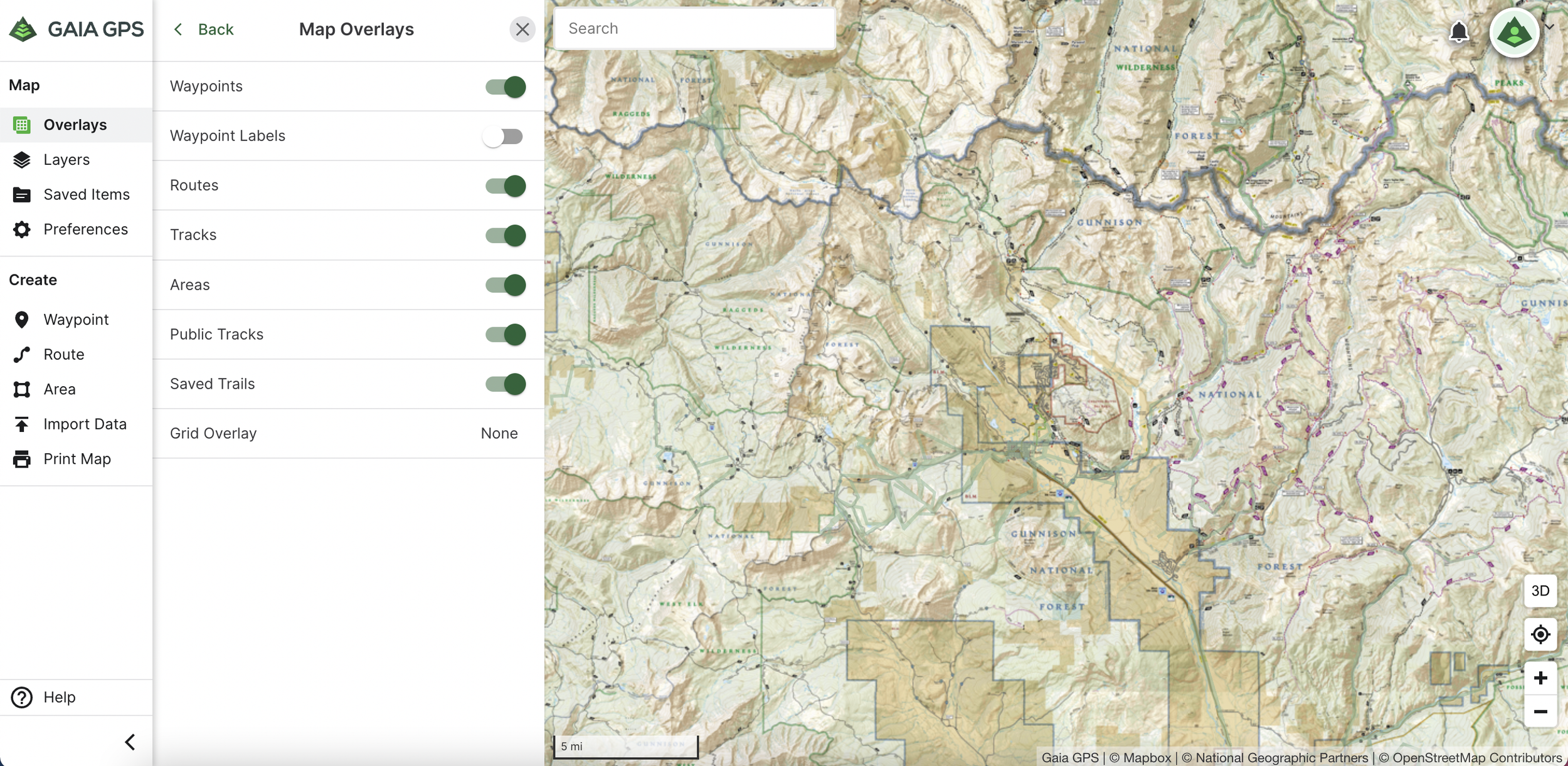
Something else that they offer that we reference a lot is public tracks. Under these, if a user has made their GPS track public and added trail information into it like obstacles, you may be able to learn a lot about a planned route. Gaia will also show users uploaded tracks in a heat map style. The bolder the line, the more tracks have been recorded along that route. However, it’s important to know that there is no differentiation for vehicle tracks, hikers, bikes, and so on. So, this can be useful information, but it can also get you into trouble. But probably the best tool that Gaia can offer for this is good old tried and true topographical maps. Even though they won’t show all the details, a lot can be learned about the terrain we are considering traveling through. For example, does the road traverse a steep slope, or does it climb or descend down a steep tight gully or wash? Are there any areas that may have really steep or tight switchbacks? All important information to learn before venturing out.
This is one area that we think OnX actually does a better job in where they will occasionally have trails or routes that are rated by difficulty. Truly, we don’t use this app just because we find it a bit clunky and difficult to use, but they do offer some of the best trail ratings, specifically geared towards the off-road crowd.
Lastly, a really good place to look for information is on forums and Facebook groups. Occasionally, you may be able to find current route conditions within these places. If the planned route passes through BLM or Forest Service land, you may be able to call those field offices and often get current route conditions or closure information.
We think that of all of the tasks of finding a camp, determining road conditions to get to those spots is the most challenging part, and we certainly have turned around en route to a camp spot more than several times. Often we are setting off with a whole lot of unknowns in this department (part of the fun for us!), and that illustrates an important point! Always have backup spots planned out, or at least while traveling into a new area, keep an eye out for good plan B or even C spots. This is true if we arrive at a spot that is already occupied as well.
Adding to this, we generally always try to be settled into camp several hours before sunset, one of our least favorite things is trying to find camp after it’s dark, or when we are hungry and have been driving for too long. So we really feel like this is a part of planning out trips that need the most attention. Not to mention one of our favorite things is to be fed, cleaned up, and beverage-in-hand to enjoy the sunset.
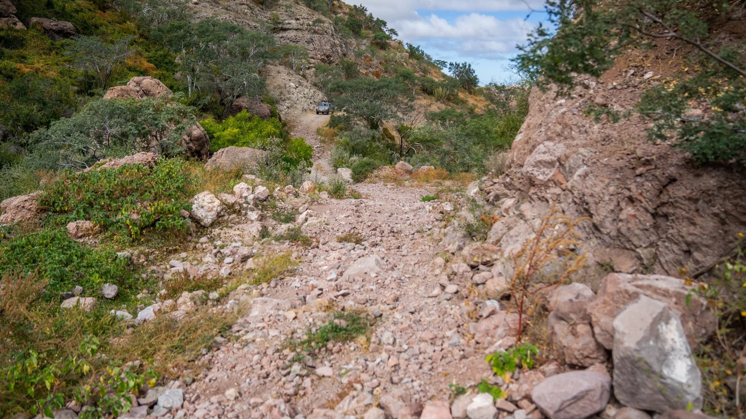
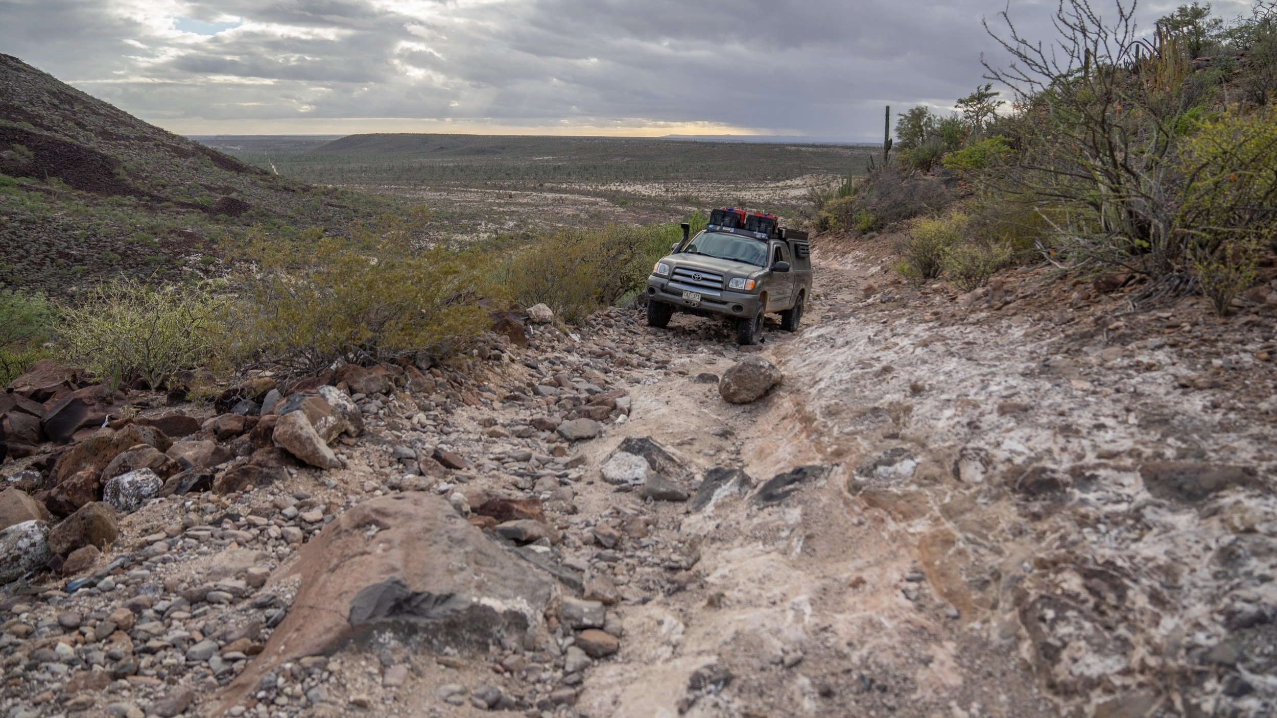
Dolores sitting on the opposite side of a washed-out section of trail that we ultimately turned around on rather than attempting.
So there it is, the not so short, short version of how we find camp.
Finding really amazing camp spots while planning a trip can be a little tricky sometimes, but with the help of various tools like Google, iOverlander, Gaia maps, and online forums, you can gather a wealth of information to help you make informed decisions about where you might call home for the night. Remember to keep backup spots planned out and allow plenty of time to settle into camp before sunset, so you can enjoy a well-deserved rest and take in the beauty of your surroundings. With a little bit of planning and a willingness to explore, you’re sure to have an unforgettable camping experience. We encourage everyone to explore the great outdoors but also to do so responsibly and with the utmost respect for nature and its preservation. Happy trails and we hope to see ya out there!